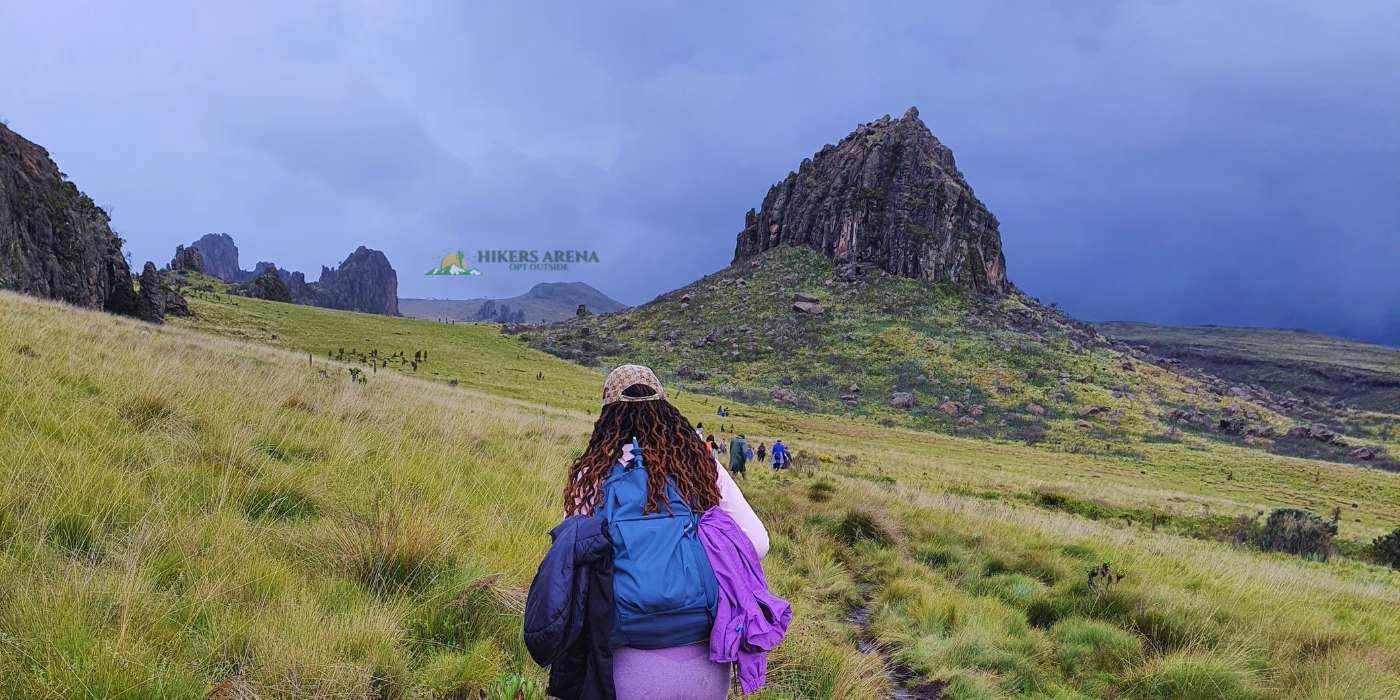
Mount Kinangop Upsweep is your true test for resilience on your journey to big mountains. Standing at 3906m ASL, Mount Kinangop is a stunning peak located in the Aberdare Range of Kenya, known for its challenging day hike that offers breathtaking views of the surrounding landscape and is the second tallest in the Aberdare Ranges. The hike begins at North Kinangop Forest Station and takes you through lush forests, a bamboo region, open moorlands, and rocky terrain, providing diverse experiences. The bamboo region is rich in green and nourished vegetation, and we should beware of the Urtica dioica (stinging nettle). When you near completing the Bamboo region, the trail gets steeper and slippery, and with the rainy season, there will be a muddy section before the ascent to the moorlands. The moorland is a heaven of views, with various aberdare peaks, such as Elephant Hill being visible, and the 12 Apostles as you near the Summit. At the summit, a very steep protruding rock leads to Mount Kinangop’s pinnacle. Going up this peak requires a self-meeting, balancing fear and enthusiasm, and being on all 4’s. Hitting the trek to the base of this peak will be summiting. However, we never discourage the hiker in you trying to test limits and view from higher up. If you can, we will go up this peak. The thrill starts when descending this peak. It requires more energy and care to get to the safer ground. The long trek to the car park gets even longer when you get to the Bamboo region, which seems not to end the more you descend. At that feeling, you are close to exiting the forest. At the end of the hike, you will congratulate yourself for managing 26km of a challenging trail.
Mount Satima Stats
| Approximate Distance | 28 Km |
| Approximate Time | 11 Hours |
| Maximum Elevation | 3996m (at the summit) |
| Difficulty | This hike needs someone who is either a gym bird or has done at least one high-altitude hike before. This must be supported by good physical health. |
Hike Essentials
| What to Wear | What to Carry |
| A hat or a baseball cap | At least 2L water |
| Sports attire | Electrolyte replenisher (Hydration mix, smoothies, crisps, nuts) |
| Hiking pants or shorts with tights | Rain poncho/raincoat |
| A windproof down jacket | Hiking stick |
| Well-treaded hiking boot/gumboot | Identification document/soft copy |
| Sunscreen/petroleum jelly |
It is Also Advisable to Have
- A set of clothes to change into after the hike (sometimes, the good hiking gear also fails, and weather changes are unexpected).
Ticket & Booking Mount Satima
| Residents (KES) | Non-Residents (USD) | |
|---|---|---|
| Shared Transport | 4550 | 98 |
| Self-Drive | 2500 | N/A |
| Booking | 2500 | 40 |
Residents: Use the booking panel for tickets (recommended). We allow a booking fee as described in the table above, and then you can clear the balance before departure. Pay your booking fee using these payment details.
Non-Residents: We allow a booking fee as described in the table above, and you can clear the balance before departure. Click Here to Pay in USD.
Note:
For bookings, the balance shall be cleared before departure.
Hikers Arena Refund Policy applies.
Click here to see the ticket inclusions & definitions.
Trip Route
Nairobi-(via Thika Road)-Nyeri
Inquiries and Updates
For inquiries and updates, contact us or join our Whatsapp Updates Forum (Click here to join) to keep up to date with our activities and upcoming events.
[itinerary title=”Departure, Hike & Return” number=”1″ style=”default”]Meeting point: City Hall Way (Kencom) opposite International House Entrance, CBD.
- 2.45 am: Boarding opens
- 3.00 am: Departure for Aberdare Rhino Gate (The departure time is strict)
- 7.00 am: Arrival at the Aberdare Rhino Gate and registration
- 8.00 am: Arrival at the Twin Rocks & hike starts
- 1.00 pm: Mandatory turn-back time for everyone
- 5.30 pm: Departure for Nairobi
N/B: The departure time back to Nairobi is subject to the day’s tidings and could be earlier or later than estimated.[/itinerary]
